Saturday, July 16, 2016

Sliding Rock and Looking Glass Falls


 Neither Sliding Rock or Looking Glass Falls are what you would call a hiking adventure unless you consider having to walk from the distant overflow parking lot a hike.  But a jaunt can be either on foot or by car. 


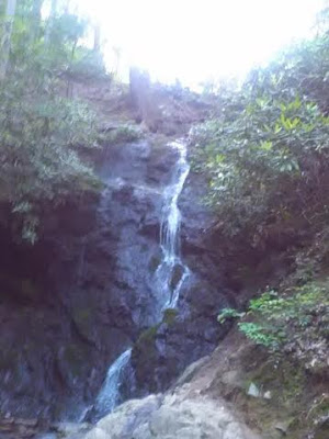
Looking Glass Falls

A brief video of Looking Glass Falls,  just to give the majesty of this waterfall.  Aaron was to the far right and wanted to go under the waterfall, but probably took the wrong route and found the rocks under his feet to difficult to walk on.


Aaron at Sliding Rock

I lost track at how many times Aaron slide down in the hour and a half we were here. At around 5 pm the crowds started to clear out, and there was hardly any wait to get back on top.


Jason at Sliding Rock

I went down once just to say I did it. The water was like ice!

Friday, July 15, 2016

Blue Ridge Parkway-Little Sam Trail

We started and ended our hike at the parking lot of the Devils Courthouse on the Blue Ridge Parkway near mile marker 422.  


We may not have looked tired in this picture, but we were exhausted after hiking for almost five hours. The Devils Courthouse Trail is one mile to the top, but at 0.3 miles there a spur trail that goes to the left and takes you over the Blue Ridge Parkway on the top of Devils Courthouse Tunnel. Our plan was to climb the rest of the 0.2 miles on our return trip back, but exhaustion prevented us from doing so. 


Just before we reached our first trail junction with the Mountain-to-Sea Trail, we came to a huge patch of wild Blackberries. Unfortunately, they were not ripe for eating.


At times while on the Mountain-to-Sea Trail, our path took us through a narrow passage of armpit height undergrowth.


Gypsy and I are walking through the mountain jungle.


Going pass these yellow flowers we became mesmerized with a strong smell of butterscotch. If we had to guess what the name of these flowers was, I would say they are Buttercups.


A distant view of Mt Hardy.


After two miles of strenuous hiking, we took a break along this creek. 


Just before the junction with the Flat Laurel Creek Trail we maneuvered through this boulder garden with a high rock face to the left. We took another break here and ate some beef jerky while sitting upon the large stone you see on the right.


Some wild grass that reminded Aaron of wheat, They had heads of grain on their tops, and as you brushed past them it tickled your legs,


These mushrooms look like the pancakes Aaron cooked that sent the fire department to our house.


This hike became somewhat of a disappointment because we again failed to climb Sam Knob and didn't make it to the top of the Devils Courthouse either. We hiked every conceivable trail there was between the two elevations. What I thought to be a 4.2-mile excursion from mountain top to mountain top turned out to be much further. We walked close to 6 miles on trails that were rated strenuous, and it took much more time than I had allowed for considering we had other destinations to visit on this day. When we started our climb of Sam Knob, we asked people who were coming down how far it was to the top of the summit, and they said another half hour climb. That took the wind out of our sail knowing how far we had to walk back to the Jeep.


Sunday, July 3, 2016

Carolina Beach State Park-Sugarloaf Dune and Carolina Beach @ Freeman Park


The Carolina Beach State Park and Freeman Park are not connected, but Aaron, Gypsy and I enjoyed both locations on the same day. 


A short but interesting trail.


The carnivorous Yellow Pitcher Plant! "Insects prey are lured into the slippery waxy portion of the upper pitcher tube by nectar, they slide down a coating of ultra-fine, downward point hairs, hitting the digestive enzymes, and into a zone which readily absorbs nutrients."


We started our hike just about high noon on a near 90-degree day. Walking through a longleaf pine savanna on a white sand trail made it seem as if we were hiking through a desert. We quickly finished off the 32 ounces of water we were carrying.


As we approached the dune, we encountered some oaks covered in Spanish moss.


High upon the dune we looked down on the Cape Fear River. This spot had some historical significance because it was a landmark for ships looking for Wilmington and back during the Civil War the Confederacy used the dune to defend the port. 


The Cape Fear River


Once the Sugarloaf Trial swings back inland, we pass several sinkhole ponds.

There was defiantly a lot of interesting things to see that you normally wouldn't in your everyday activities. All this was pack into a short but hot 2.8 miles! 


________________________________________________

Carolina Beach at Freeman Park 


We were kicked off the beach further south because we had Gypsy in tow. We were told to go North to where the fishing pier is and Freeman Park. Not only were dogs allowed but for a parking fee, we could have taken my Jeep also on the beach.


Almost immediately after stepping foot on the beach Aaron ran headlong into the water with Gypsy following. Within seconds they both were hit by a giant ocean wave which took them off their feet (paws in Gypsy's case) and deposited them back upon the shore.

I was wondering what Gypsy was going to do because anytime she sees water she drinks it, One small lick of this water and Gypsy's instinct told her the water wasn't safe to drink.

After enjoying the warm Atlantic water, we took a long stroll down the beach where we meet a lot of interesting people. Many came up to us wanting to pet our beautiful dog.


Great Smoky Mountains National Park- Cataract Falls and Fighting Creek Nature Trail


I knew nothing about the Sugarlands Visiters Center, but I arrived and began to walk down a trail any trail. Totally by happenstance, I ended up on the Fighting Creek Nature Trail. I also had no idea that there was a waterfall in the vicinity until I stumbled across this intersection.  


The trail leading to the waterfall is called the Cove Mountain Trail, but the Cataract Falls is just a short distance at 0.1 miles.  The trail hugs alongside the Fighting Creek much in which we walked on a boardwalk. It is somewhat confusing on how I ended up here from the Fighting Creek Nature Trail. There must be some connector trails that isn't shown on the map I used.


A few hundred yards towards the falls there was a sign with a picture of a dog with a red circle and a black slash going across the picture. I was here with Gypsy and by gum, I was going to see this waterfall.


If I had the time, I would have gotten a real good education on identifying the different plant life that grew in the Great Smoky Mountains and North Carolina in general. The Fighting Creek Nature Trail had many of these placards that identified what you were viewing. What I was viewing here was a Mockernut Hickory.


 A log bridge that crosses over a small brook.


Hiking in late evening through a dense forest was a nice break from the intense heat of the day.


The Fighting Creek Trail begins its loop back at this historic John Ownby Cabin. Built in 1860, and the last surviving structure from the pre-park Forks-of-the-River community. I didn't think of taking a picture of this cabin; this picture is courtesy of  Wikimedia Commons.

Saturday, July 2, 2016

Great Smoky Mountains National Park-Gatlinburg Trail


Just outside the city limits of Gatlinburg, Virginia about a half mile past the last stop light on U.S 321 South you.Enter the Great Smoky Mountains National Park.  


You can start your walk at the large National Park sign or begin at the actual trailhead on River Road about one-third of a mile towards town.


The main attraction is the stroll along the banks of the West Prong of the Little Pigeon River. There are plenty of places to take your shoes off and wade in the water. There are also places you can relax and hear the roar of rapids cascading of rocks and boulders.


Half of a mile from the trailhead we crossed the river on a mostly wooden pedestrian bridge then continued to follow the West Prong of Little Pigeon the rest of the 1.9 miles.


The view of the West Prong from the bridge.


Would have been a beautiful homestead, but all that was left is the chimney and fragments of a foundation.


 The Gatlinburg Trail goes under the Gatlinburg Bypass, and this is just about at the halfway point.


 With the trail being so close to town and the relatively flat terrain this is where most people go who wants to take a walk or ride a bike other than on the busy streets and sidewalks of Gatlinburg. It was a nice getaway After dinner and before dusk.