The Bicentennial Greenway is advertised as being fourteen miles long, but the Greensboro section of the greenway is not continuous and have gaps of nonexistence or undeveloped portions. The High Point section is 6.6 miles of uninterrupted greenway that takes you through hardwood and pine forest, lakeside habitats, and follows along a scenic East Fork Deep River.

You cross the bridge over High Point Lake and between the property of the John McClain American Legian Post 196, and High Point Lake is the official beginning of the Bicentennial Greenway. There is no parking here but another quarter of a mile further down Penny Road at the Piedmont Environmental Center you will find a 32 car parking area.

Every quarter of a mile is marked with a yellow painted mileage post.

At the Environmental Center, there are 11 miles of nature trails, plus educational activities and classes. The Center's address is: 1220 Penny Road, High Point, NC 27265

This covered bench has come in handy a few time when I have gotten caught in a storm. There are a couple more of these along the greenway.

Just past the half mile post, there are the only stairs that you will encounter on the greenway. If you notice the narrow strip of a board that is to aid bikers pushing their bikes up the steps.
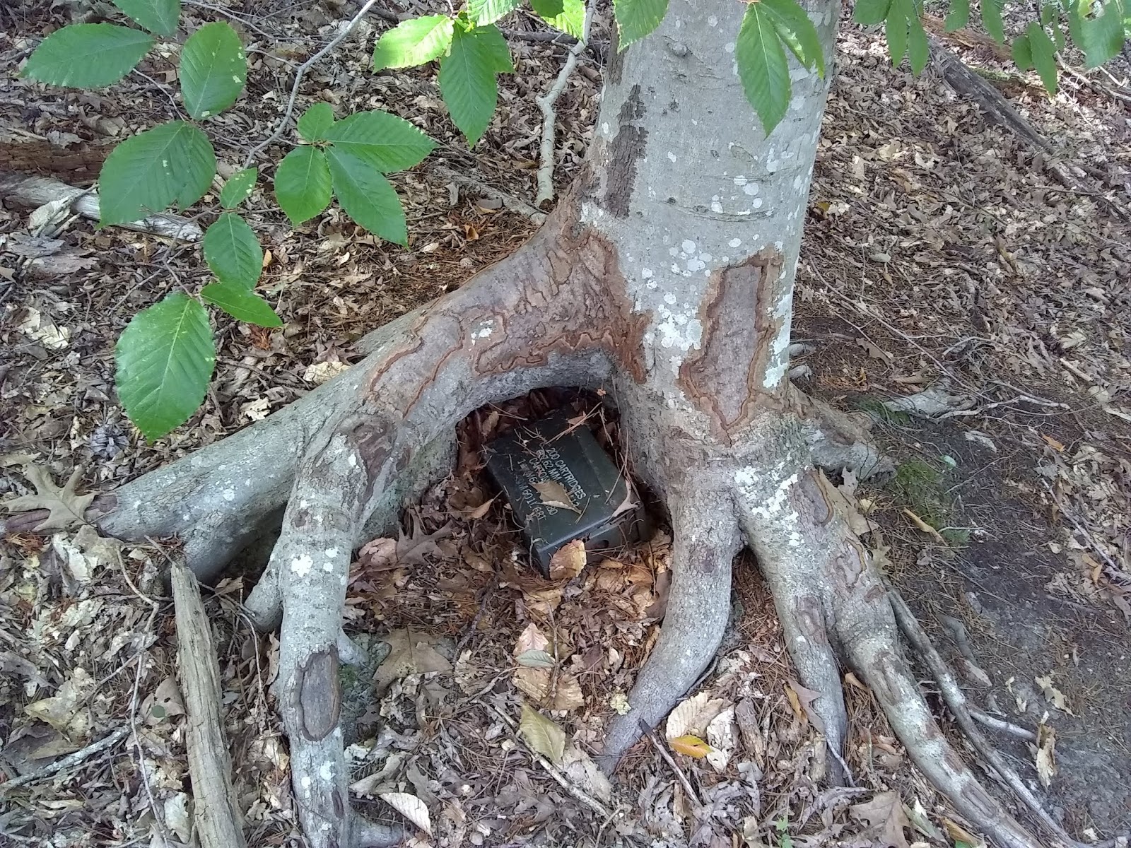
A Geocaching container that Aaron and I found 30 yards off the path. Geocaching is an outdoor activity, in which participants use a GPS receiver or mobile device and other navigational techniques to hide and seek containers called "geocaches" or "caches," at specific locations marked by coordinates all over the world.

For the first mile, you continuously have a view of the lake and the various lakeside habitats. I have seen turtles, cranes, herons, geese, ducks, beaver, and deer.

Seeing deer close up is nothing unusual. This picture of a buck was not taken on this particular walk but on August 8, 2016.


I have just crossed the East Fork Road headed into the North Preserve. The greenway goes away from the lake through the hardwood and pine forest, while the Deep River Trail follows along the shore.


Passing by an old pine plantation.


It was 91 degrees this day, but I brought plenty of water for both myself and Gypsy. We took breaks along the way. At the shady spot, the grass was still moist, and Gypsy was enjoying its comfort.

A bike station at Gibson Park.


Gibson Park is just past the 3.5-milepost. It has flush toilets, picnic shelters, Pop (soda) machine, and other things you usually find at a park. This is a historic log cabin.


The tunnel going under the very busy West Wendover Ave.


The East Fork Deep River.

A long boardwalk just before crossing the Piedmont Parkway at about the 5-milepost.

Crossing over the Piedmont Parkway. Some pretty rock work through the median strip.

One of several picnic tables you will find along the greenway.

The end of the Bicentennial Greenway (High Point Section) at the intersection of Gallimore Dairy Road and South Chimney Rock Road. The greenway continues again about 3.7 miles away at the dead end of Swing Road near West Guilford High School.

After a pleasant but hot North Carolina Summer stroll down the Bicentennial Greenway, we are relaxing back at the Piedmont Environmental Center's porch.


