Thursday, May 19, 2022

Negwagon State Park - Algonquin/Chippewa Trails


The Algonquin hike was done on August 26, 2021, and on June 21, 2022, I hiked the Chippewa Trail. From the parking area to the tip of the peninsula is 2.5 miles. Going back to the Twin Pine Campsite's intersection, then going West on the Algonquin, and looping around to the parking area is a 5.6-mile hike.


The trail takes you through some dense forest.


On the map above, you noticed different shades of color. The yellow represents grassland,  gray represents lowland conifer, dark green represents lowland shrub, light green represents northern hardwood, and blue represents wet meadow. This boardwalk kept hikers' feet from getting soaked in the wet meadow areas.


This is the first of four campsites. I hope to camp here the night of June 21, 2022.


The campsites have a picnic table, firepit, bear-proof trash can, and pit toilet. All give you a fabulous view of Lake Huron. I'm going to be falling asleep to the sound of waves. 


I could not hike the Chippewa Trail due to a Bald Eagles nest. I hope to be able to walk it the next time.


This portion would be the grassland.


The end of the trail came to this narrow rocky peninsula.


Took a selfie of Gypsy and me at the very tip of the peninsula. 


This is what was behind our selfie picture.


The Algonquin Trail was a bit less traveled on the loopback.


 The Chippewa Trail still had the eagle's nest, but the DNR officer said it was more of a suggestion not to hike the trail. It was a challenging hike with fallen trees and lots of water and muck to walk through.


Basically, you walked through a little clearing through the woods. I love trails like this!


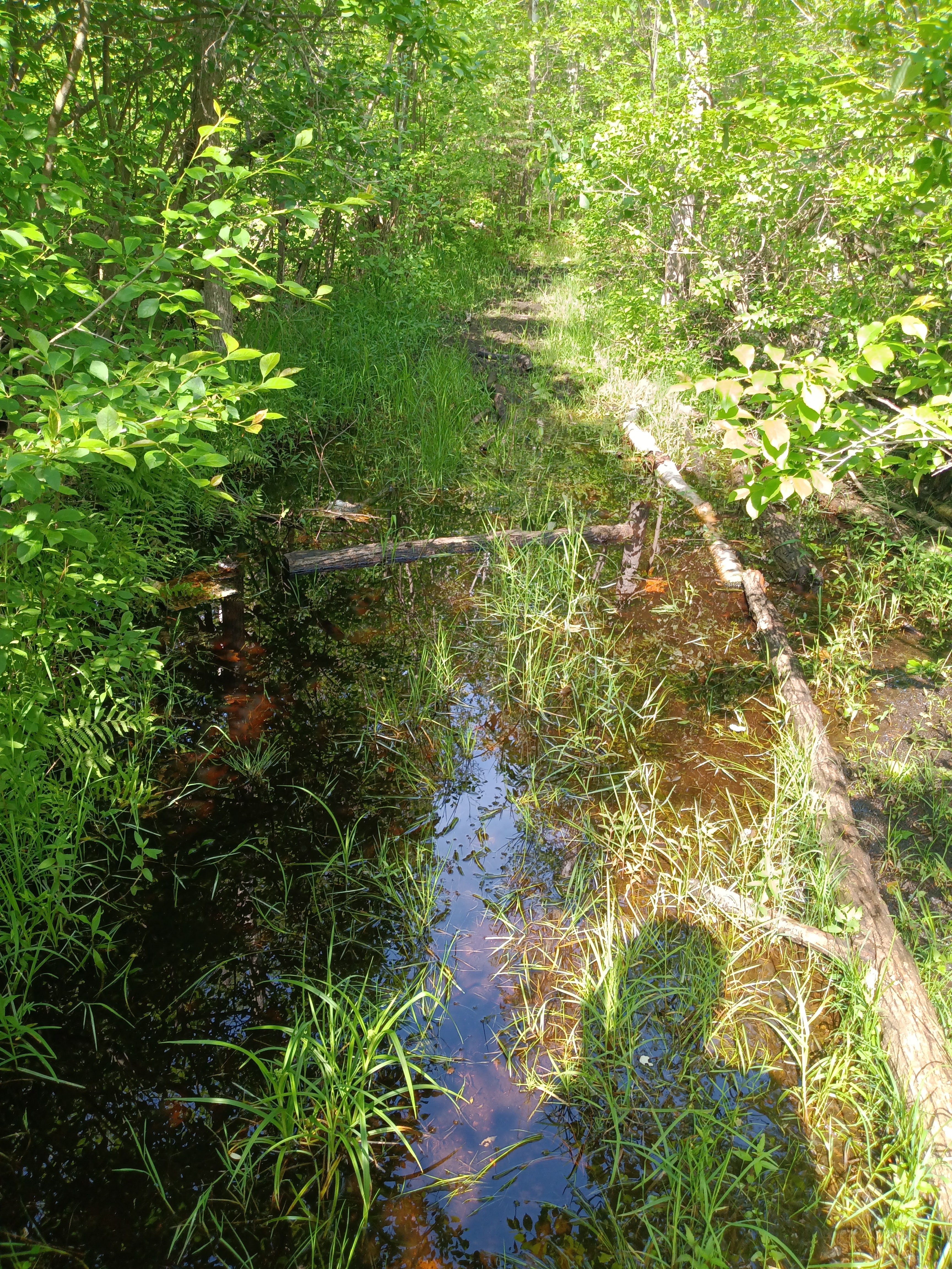
I had to walk through swamp water many times on the Chippewa Trail.


Because of the eagle's nest, which I did not see, the DNR is not maintaining the Chippewa Trail even though I was looking for it. There were numerous times I had to climb over and under to go around fallen trees. 


You will recognize the names (Algonquin, Potawatomi, and Chippewa) as Michigan Indian tribes if you're from Michigan. The park is named after Chief Negwegon of the Ojibwa tribe who lived in the area.  

Negwagon State Park - Potawatomi Trail


The Potawatomi Trail starts at the South end of the parking area. As you start from #7 and hike to # 8, it is 1.8 miles. The loopback trail has Lake Huron pretty much within an eyes view. The total distance is 3.9 miles. 


A typical view of the trail going south toward #8 


Eventually, the trail and Lake State Railway line run parallel together. These tracks were the more well-known railway line called the Detroit and Mackinac line. In 1992 it was bought by Lake State Railway Company (LSRC).


The trail on the hike back to the parking area becomes quite sandy in spots because of being close to the shoreline.


There is a strip of forest between the trail and lake, but you get these openings and catch a distant view of Lake Huron. Especially on a windy day (you can see the whitecaps), the sound of the surf was loud and could be heard even if the lake was out of view.


These are pictures from a hike on August 27, 2021.

Thursday, May 5, 2022

Raven Rock State Park -Campbell Creek Loop Trail and Lanier Falls


The Trailhead.


Gypsy enjoys a splash and drink in Campbell Creek.

The trail followed closely along the creek's embankment for a significant distance.  


A huge turtle was sunning itself on a log. Its head is up, and he is aware of our presence and is about to disappear into the water.


The Lanier Falls Trail is a short 0.2 appendix trail to the Cape Fear River. 


The Cape Fear River is quite broad.


The Lanier Fall isn't a spectacular waterfall but a waterfall nevertheless. 


Quite noisy.