Sam Knob and Laurel Creek is a combination of two trails that creates a loop hike. Sam Knob trail is an out-and-back trail to a high-elevation knob. On today's excursion because of the late start and Aaron having the lack of energy we did not hike up the Sam Knob Summit, but turned left to where it junctions with the Flat Laurel Creek Trail and did a circle. We will at a later date visit the knob when we hike the Devils Courthouse.going via Little Sam Trail.
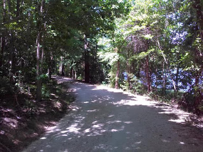
The Sam Knob Trail starts at the side of the parking area next to the restrooms. The trail surface is a gray crushed rock and relatively wide like you see in the above picture.
Once you descend these stairs, the trail begins to be more of a footpath
As you approach the creek, it became a little bit swampy and washed-out. This staircase like boardwalk provided for sure footing.
The embankment you walk down to cross the Flat Laural Creek.
No bridge, but plenty of rocks to help keep your feet dry.
The view upstream (above) and downstream (below) of the Flat Laurel Creek standing on a rock in the middle of the creek.
The picture may lead you to believe that you are looking down a stream, but it just happens to be a wet portion of the trail. Today we encountering two horseback riders.
We came at the right time to see a variety of wildflowers in bloom. The only flower I could identify is the Rhododendron.
I wish we had time to climb Sam Knob, but I now have something to look forward to on my next hiking adventure. We did have a bear sighting on this trip! It wasn't deep in the woods of the Smoky Mountains, but as we were leaving the Log Cabin Pancake House on Airport Road in Gatlinburg, a bear ran right in front of us and disappeared down an alley.That's probably the best way to meet a wild bear.


