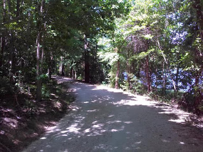
Salem Lake and the trail that circles it is a Winston-Salem oasis. The shores of Salem Lake is entirely undeveloped except for a park and marina located at the West end of the lake. The 7 miles is an easy hike because it is mostly flat terrain. Despite it being a 92-degree day the dense forest created a canopy over the trail that kept Gypsy and I shaded.
This intersection was both my starting point and ending.
Squirrel!
A Whitetail deer leaped across the trail then stopped and looked at us long enough for me to snap its picture.
A typical view of Salem Lake Trail. Wide, flat, and right next to the shore.
Plenty of shade and a 14 mph breeze made a 92-degree day bearable.
The East end of the lake along Linville Road.
A Salem Lake view from the East end next to Linville Road.
Every yellow dot you see on this map, there is a sign like this one showing where you're located.
Turning 180 degrees from the sign above is my view of this cove along the South shore.
My final view of Lake Salem on the East end. I completed my hike in 3 1/2 hours.
It is understandable why Salem Lake made Joe Miller's list of 100 Classic Hikes in North Carolina. Aaron and I bicycled this trail the very next day.
This picture was taken the following day when Aaron and I bicycled the 7-miles. We are taking a break at some benches along a creek.
I have never seen anything quite like this before. It's the ultimate refreshment station. At the bottom there is a drinking fountain for you dog, then another for you. On the other side, you have filtered water to refill your water bottle. What Aaron is doing in this pic is having a cool mist of water spray on him from above. The fountain located a the Linville Road Parking area at the East end of Salem Lake.


No comments:
Post a Comment