Monday, September 28, 2020

Hanging Rock - Wolf Rock Trail


 A quarter-mile down the Hanging Rock Trail you see a sign just like this one with an arrow pointing right for the Wolf Rock Trail. Follow the Wolf Rock Trail for almost a mile to this spot and 50 yards off the trail is Wolf Rock.


This is a side view of Wolf Rock,


This is about as close to the edge I dare to go.


This is the direction Gypsy was looking in the picture above and what we viewed. That stack of rocks looked like a giant cairn.


The view of the valley below is almost like being on an airplane.


Portions of the trail were quite rocky. You had to be careful or you could twist and ankle. Overall this wasn't really that strenuous of a hike and only 1.1 miles from the parking lot (2.2 miles round trip).


Thursday, September 10, 2020

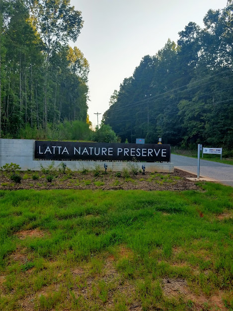
Latta Plantation


Just North of Charlotte a short distance off of Interstate 77 is the Latta Plantation Nature Preserve.  


The entrance to the preserve is 1 mile down Sample Road.


My hike began at the parking area just before the Latta Equestrian Center starting at the Hill Trail Trailhead, you go about three-quarters of a mile and arrive at a fork. You can go either way and will eventually a few hours later circle around to the same intersection. I went left (counter-clockwise). 


According to author Joe Miller, prairies were once common throughout the Piedmont region. The proof of that was Spanish explorer Hernando de Soto made note of the open "savannas"  during his trek through the area in 1540. This is my first time viewing a Piedmont prairie and this one wasn't more than 10 acres in size. 


At an intersection of Split Rock Trail  & Rock Hill, you'll come across this "prairie restoration project" which is some historical equipment. 


A half-mile down Split Rock Trail you follow along the shore of Mountain Island Lake. The lake was created in 1924 which is a lake created by a dam of the Catawba River. It wasn't extreamly hot (85 degrees) but I had forgotten my day packpack which I carry Gypsy water bowl and bottled water. She was really thirsty and I was glad she could be refreashed.


Lots of boaters out on the lake this beautiful day. I hiked along the edge of a prairie, through a forest, and along the shores of a lake (5.6 miles according to my All Trails app). The City of Charlotte is fortunate to have this preserve and man-made lake within a half-hour drive.

Monday, June 22, 2020

Lower Haw River State Natural Area

I split this hike up into two separate 4-mile hikes. The first hike was on May 14th starting at the NC Highway 64 parking area.


From the parking area, you go down to the river and turn right heading upstream going under the Highway 64 bridge that crosses the Haw River.


The trail is unmarked and sometimes the footpath disappears completely due to overgrowth or you have to step over logs laying across the path and go around trees that have fallen.


This Haw River was relatively shallow and quite tamed on this day.


While going upstream there are two creek crossings. There are no bridges, so you pick your crossing spot.  It wasn't much of a problem on this day because this first creek barely had any water flowing in it.


 On June 19, I returned to finish hiking the Lower Haw River Trail starting my hike at Bynum Park.


Lots of rain from the previous days give the Haw River an intimidating look with some sections flooded and moving very rapidly. 


Not all that intimidating here.


I found it interesting looking at the various track in the mud. Along with human and dog tracks, I see what could be a raccoon and some other unidentified tracks.


Pokeberry Creek created a challenge for me to cross. I had to travel it upstream for 1/4 of a mile until I could find a place to wade across in ankle-deep water. The creek measures about 15 yards wide.


The Lower Haw River Natural Area had all sorts of trees and plant life. Red Oak, black gums, hickories, elms, sourwood, and this tall Red Pine. I carry a day pack with me which usually has three 16 oz bottles of water, toilet paper, Gypey's water bowl, dog biscuits, and an energy snack for me. If it's a wilderness area or not a heavily traveled trail I'll carry my bear repellent and some other survival items.

Lake James- Shortoff Mountain Trail

"This may be the best view in North Carolina," says, author Joe Miller. 


The Trailhead. 


Two miles of steadily upward climb totaling an elevation gain of 1155 feet.


Cold freshwater for Gypsy. I was able to save my bottled water for myself and filled her water bowl with this.


A magnified closeup picture of Lake James. The lake is 1200 acres in size.


   I had a constant view of Lake James for most of the hike. This is the actual photo.


As I neared the top of Shortoff Mountian the trail became a bit more vertical. The trail developers aided hikers with some rugged stairs.


 Looking down at the 12-mile long Linville Gorge from the 2883-foot Shortoff Mountain.


An intersection where the Mountain-to-Sea Trail crosses the Shortoff Trail.


Shortoff Mountain is open to backpackers and campers. This would be a fantastic campsite.


At the top of Shortoff Mountain was this pretty little mountain pond. This is where I ended my hike and began the much easier descend back down the mountain. Thanks to my app All Trail it gave me all sorts of information. My hike totaled 4.7-miles and it took me 3:17:50 hours. I had an elevation gain of 1155 ft and burned 1516 calories which most of that I'm sure was on the way up.  

Sunday, May 10, 2020

American Tobacco Trail

The American Tobacco Trail is 22.2-miles in length and I hiked the 5.7-mile portion recommended by author Joe Miller (100 Classic Hikes North Carolina). I hiked the New Hill -Olive Chapel Road Access to the White Oak Church Road Access.


All trail parking areas are identified with a sign that looks like this (at least those in Wake Country)


 A typical view of the trail with a natural surface. Hikers share the trail with bikers and horse riders.


 The Beaver Creek bridge. Each bridge has a small gold-colored placard identifying what stream you're crossing.


 A view from the Beaver Creek bridge.


Reedy Creek bridge


White Oak Creek bridge


Muddy brown waters of White Oak Creek


The story of the tobacco industry.


An old tobacco barn


Since I couldn't hike 11.4- miles all in one day, I split the hike up into two days with the first hike of 5 miles from New Hill Olive Chapel Road traveling North to the tunnel under Highway 64 then back.


The second day I started at White Oak Road Access and hiked South to the Highway 64 tunnel and back for a total of 6.4 miles. I can see where we get the phrase "the light at the end of the tunnel." 

Sunday, April 12, 2020

Atlantic & Yadkin Greenway - Palmetto Trail

The Atlantic & Yadkin Greenway is a Rail-to-trail project. I started at Strawberry Road located at the north end of Brandt Lake and I went SE towards Lake Brandt. The Greenway starts at NC Highway 150, 1.7 miles the other direction across the road.


A cleverly designed sign marking the name of the greenway.


 About a third of a mile, Gypsy and I crossed over the north end of Lake Brandt on this footbridge.


The greenway passes by the Bur-Mill Park. Here you're looking at a bike repair station including an air pump.


This sign tells you all about the A&Y railway.


I took the Palmetto Trail in a counter-clockwise direction. This trail goes around the south end of Lake Brandt then turning left on the sidewalk along Old Battleground Road for a few hundred yards I headed back to the greenway via the Nat Green Trail.


A peaceful forest walk.


A walking bridge over the Horsepen Creek alongside the Old Battleground Road. It looks to me like an old railroad bridge.


 Heading back on the Nat Greene Trail, a rough estimate but this boardwalk was 180 steps and assuming I have the average man's stride of  2.5 feet, that would make this 450 feet long.


H. Michael Weaver Bridge over the south end of Lake Brandt. From here just a few hundred yards is where I entered the Palmetto Trail and I return the 1.8 miles retracing my same route back to my parked vehicle.