Saturday, August 25, 2018

High Point Greenway


 New signs that were added to the High Point Greenway in 2020, along with a new section connecting the High Point Greenway starting at Armstrong Park to the Bicentennial Greenway ending at the Piedmont Environmental Center, totaling4.5 miles.


A long gradual downward slope that would be awesome to ride a skateboard on.


The new sections which were opened in 2019, started at Penny Road and go between two residential areas then you come to a 1/2 mile of nothing but boardwalk the weaves through a swamp.


 The bridge over the Deep River.


View of the Deep River and boardwalk crossing the Boulding Branch


I got to see a game being played that I had heard about, and that is sweeping the nation.  Many former tennis players are now playing pickleball and old deteriorating, hardly ever used tennis courts are being refurbished into Pickleball courts. 


 The campus of High Point Univerity.


HPU baseball diamond.


 There are two tunnels one goes under  N.Cennenial St. and the second tunnel goes under U.S. 311/I-74.


One of the fancy crosswalks.


One of many bridges over the Boulding Branch.


A bridge view of the Boulding Branch.


Here is where  High Point Greenway begins at Armstrong Park. There is a spacious parking area, dog station, and map.


Sunday, August 5, 2018

Mount Rushmore


  Mt. Rushmore!


I can scratch Mt. Rushmore off my bucket list. $10 wasn't to bad a price to pay. Our two ice creams cones cost me more. 


We are along Washington's side profile of Mt. Rushmore.


Finally made it to the backside of Mt. Rushmore. 


There are three tunnels along Iron Mountian Road just Southeast of the Mount Rushmore National Memorial. The three tunnels are called Scovel Johnson Tunnel, Doane Robinson Tunnel, and C.C. Gideon Tunnel. I'm not sure which one this tunnel is.


A distant view somewhere along Route 244.


Aaron skipping some rocks at Stockade Lake. 


The Broken Arrow Horse Camp and RV Park near Custer, South Dakota is where we ended up camping. Not surprisingly most the campers here were horse riders, and we saw plenty of people wearing cowboy hats, boots, and had big belt buckles.


Behind our tent is one of many horse stalls. Most all the trails at the Custer State Park were open to horseback riding. A small world we live in because the owner did some ATV riding in Luzerne, Michigan area and was a patron of Ma Deeters.

Saturday, August 4, 2018

Black Hills Forest/Black Elk Wilderness- Iron Creek & Iron Mountain Trails


The Black Elk Wilderness is part of the Black Hills Forest.


Iron River Trail weaved over the Iron Creek numerous times. 


Because a receiving more than an inch of rain the night before the creek was a raging torrent.


The second wooden-plank bridge.


The third bridge was out and so ended our hike of only one mile down the Iron Creek Trail. We thought about taking our shoes and socks off and try crossing, but I remembered my promise to bring Aaron home safe and thought better of that plan, so we went back as we came.


 On our car ride to the Iron Mountian Trail, we were able to see Mt Rushmore in the distance. 


 A Military Ready to Eat (MRE) lunch at a picnic area next to Lakota Lake.


Lakota Lake.


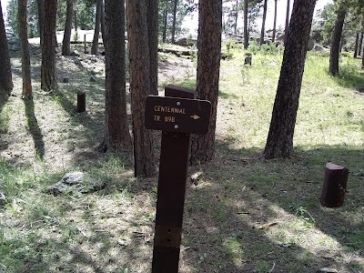
We actually started our Iron Mountain Trail hike from a Trailhead off of Route 244 within the Mount Rushmore National Memorial. We followed the Centennial Trail for a half mile then Iron Mountian forked off to the left, and the Centennial Trail continued straight.


Lots of things to consider especially if you're backpacking but for us the primary concern is having enough water and staying on the marked trail. This is the actual Trailhead of the Iron Mountian trail off of Forest Road 345.


Lots of rain made for muddy trails. Here we can't even walk on the trail due to standing water within the path.


We were delighted to discover ripe wild raspberries.

A picture doesn't really show you what I meant by a "raging torrent." This video does.

https://www.youtube.com/watch?v=U6Skmjf8ufc


Thursday, August 2, 2018

Theodore Roosevelt National Park (North Unit)-Prairie Dog Town and Oxbow Overlook


The best pictures I could take of a prairie dog with a phone camera. All those light colored spots are a prairie dog home. They call this area Prairie Dog Town. 


While hiking to Prairie Dog Town, I had the pleasure of seeing some Buffalo grazing.


 The video below the prairie dog let me get really close and didn't scurry in his hole even with the small child making all sorts of noise.


This second video you can't see much, but you can hear the prairie dog sounding the warning to all the other prairie dogs of me approaching. 


The Scenic Drive is 14 miles long or 28 miles round trip and dead ends at the Oxbow Overlook. To reach the Oxbow Overlook you follow the North Achenbach Trail 1.2 miles. 


The view from the parking area. I had thought this was the trail and walked that trail 1/3 of a mile only to dead end at a cliff.


View from the Oxbow Overlook

Wednesday, August 1, 2018

Theodore Roosevelt National Park (North Unit)-Caprock Coulee Trail


The Caprock Coulee Trailhead sign is quite informative that shows you a map of where you're going, and how long it should take. Today they had posted an extreme heat advisory.


I never associated cactus with North Dakota.


I did not see Buffalo on this particular hike, but the evidence was left behind to let me know they were somewhere, and I just wasn't seeing them with my eyes.


 The Little Missouri River


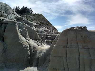
The trail took you up through the rocks at times.


I'm standing on the trail, and the post with the brown sign of a hiker is assuring me I'm not lost. Incredible, breathtaking views all along the Caprock Coulee Trail made the 4.2 miles hike in 90+ heat worth it.